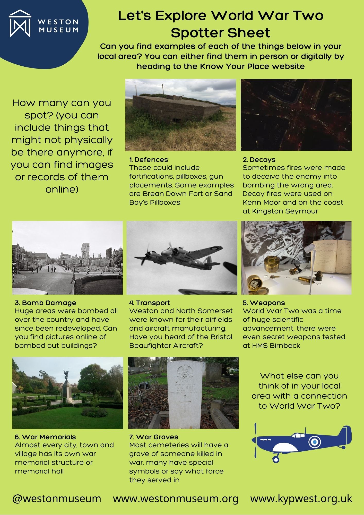
At Weston Museum, we’ve recently been exploring some historical codebreaker activities. We’ve travelled back to Ancient Egypt to look at Hieroglyphs and stopped off in the Viking era to explore runes. Now we’re thinking about the most iconic time in codebreaking history, the Second World War.
 To discover more about this era, we’re inviting you to explore your own local area to look for second world war sites and locations of remembrance. We’ve created a spotter sheet for you to download, which shows examples of the different types of world war two sites that you can look for.
World War Two might seem like a long time ago, but if you look carefully you’ll see that there are still quite a few surviving examples of structures or sites that were linked to this bit of our history. Some of these places, like war memorials or coastal defences, are great to explore on foot, but you can also explore digitally by using the amazing website, Know Your Place. Know Your Place is an online mapping resource that allows you to search through historic maps, images and information for the west of England. By using Know Your Place or looking online at other resources, such as our museum information sheets, you can also explore locations and topics that are no longer physically there, such as airfields or buildings that were destroyed by bombing.
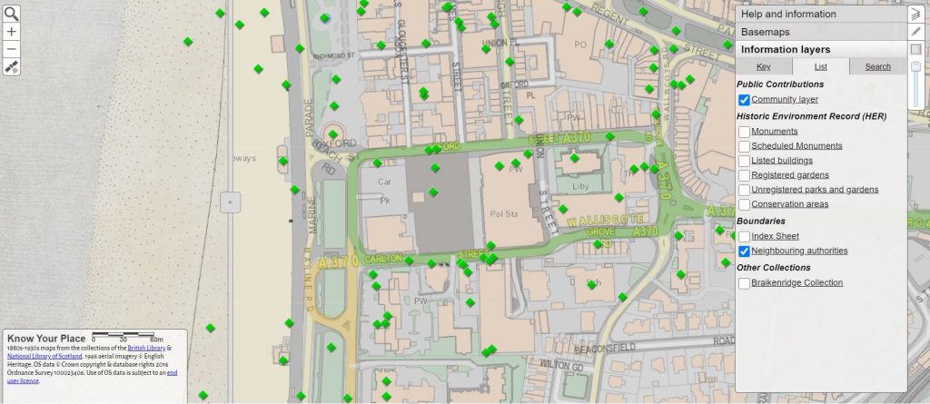
One of the amazing things about Know Your Place is that you can search for anything that interests you. If you head to the North Somerset section of the map, you will see Weston-super-Mare, which is the default setting, but you can drag the map to explore other areas. You can also drag the central bar left and right to see the other maps or to choose a variety of older maps, tick ‘base maps’ at the top right hand side of the page.
 In the information layers box near the top right, there is a tab labelled Search, you can use this to search for a monument, such as a pill box or war memorial. This will bring up all those monuments of that type, recorded in North Somerset. If you then click where it says ‘map’ in blue for each entry, it will take you straight to that monument on the map. Once there click on the right arrow and it will bring up information about the monument and a photograph, if there is one.
You’ll see that many of the monuments on the Know Your Place maps are represented as green diamonds. This is because members of the public have taken photographs, or done their own research and added it to Know Your Place themselves. You can even do this yourself if you discover something new, by following the instructions on the website. Don’t worry about making a mistake, all entries are checked by North Somerset Council’s historic environment team, before going live.
Free Activities and Updates!
If you would like to receive free activities and information about the museum’s Young Archaeologist Club ‘Rusty Club’, including more of our ‘codebreaker’ activities, just sign up to our Rusty Club Mailing List (you will only receive emails that are relevant to family friendly museum activities, we won’t send you a load of spam!).
